Torbay Local Plan Regulation 19 Publication Version and Consultation
Other elements in this consultation
Chapter 2. Shaping our places - Local identity and community-led planning View representations
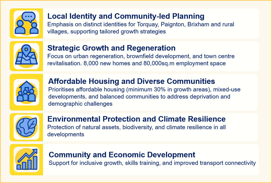
Spatial Strategy and Area Policies
Strategic Policy SS1: Torbay Growth Strategy - Prioritising our communities through improved health, housing, place making and opportunities for all View representations
All development should support the achievement of Torbay Community and Corporate Plan 2023-43 priorities. In particular, proposals should support achieving People, Pride in Place and Economic Growth priorities as far as relevant and proportionate to the scale and type of development.
Spatial Strategy
Torquay will remain the largest town within Torbay. Major urban regeneration in the town centre and waterfront is proposed to support its housing, retail and tourism role as the Heart of the English Riviera.
Paignton will retain its family tourism role, particularly around the Esplanade and beaches and will provide better public transport and active travel links to other tourist attractions within Paignton and beyond.
Brixham and its rural hinterland will accommodate more limited development consistent with meeting its local needs and supporting its role as a major fishing port and high quality food and leisure centre of excellence.
All development must be well designed having regard to function, visual appearance and add to the overall quality of the area. All development should contribute to safeguarding the area’s natural, historic and built environment. The highest level of protection must be afforded to European Wildlife Sites.
Development will be supported by the timely delivery of Infrastructure. This includes, but is not limited to measures needed to make development safe and resilient to the effects of climate change and water management, and achieving no net increase in water entering combined sewers.
All development will make full and appropriate use of opportunities for low carbon and renewable energy technologies, consistent with the need to reduce Torbay’s carbon footprint, and provide resilience to climate change. All development must be supported by appropriate and proportionate evidence setting out how it mitigates and adapts to climate change.
Development will positively address health inequalities in Torbay and contribute to shaping healthy neighbourhoods, proportionate to the scale and nature of development.
Development should, as far as practicable, improve transport connectivity and make provision for accessibility by walking, wheeling, cycling and public transportand maximise opportunities for active lifestyles.
Development should provide and support facilities that will enable social and spiritual well-being and minimise social isolation.
The Plan supports the creation of at least 80,000 sq. m of Class E(g)/B2/B8 net employment space over the Plan period, (equal to around 20 ha). with an emphasis on bringing employment space forward as early as possible in the Plan period. Future Growth Areas and strategic developments will be brought forward as mixed use developments including the provision of employment.
The Plan also seeks to deliver at least 8,000 new dwellings over the Plan period of 2025-2045 equal to an average of around 400 dwellings a year over a 20-year Plan period, with a stepped trajectory as set out in Policy HS.
Proposals for housing on previously developed land within the settlement boundary will be supported unless they cause substantial harm to the economy, environment or amenity. Proposals should contribute to creating mixed and balanced communities and avoid creating concentrations of deprivation or compounding the older demographic structure of Torbay. The council will apply the Presumption in Favour of Sustainable Development to proposals for brownfield regeneration within settlement boundaries that meet these criteria, even where the Local Plan’s housing target is exceeded.
Town Centres
Town centre regeneration schemes will be brought forward and supported where appropriate through master planning. Regeneration and urban densification corridors are identified around Torquay Gateway to Torre and Preston District Centre.
Future Growth Areas
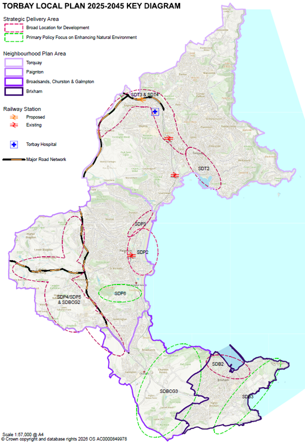
Future Growth Areas, shown outlined in red on the Key Diagram and shown on the policies map are foci for delivering growth and change in the Bay over the Plan period. They are allocated in the plan as strategic and sustainable broad locations for new employment space, homes, and infrastructure over the Plan period. They are:
SS1.1 Torquay Gateway
SS1.2 West of Paignton
Development in Future Growth Areas will be supported by updated masterplans, and/or neighbourhood plans. They will deliver a balance of jobs, homes, and infrastructure, including green infrastructure. At least 30% of new homes should be provided as affordable housing. A minimum of 25% should be provided as employment use, with a preference for on-site provision, or through developer obligations towards job creation or urban regeneration where not possible.
Other Housing Allocations
Other housing allocations are proposed in Policy H3 of the Plan and should be brought forward in accordance with the requirements in Policy H3 and provide affordable housing in accordance with Policy H7.
Major development proposals outside the built-up area, Future Growth Areas and allocated sites will only be supported where all of the following are met:
The proposal is subject to an environmental assessment that shows that:
- it is acceptable in terms of landscape, biodiversity and infrastructure impacts, including consideration of the cumulative impact of development and;
- It is demonstrated that there is no likely significant effect, alone or in combination, on European Wildlife sites (or equivalent designation); and
- Is demonstrated to meet an economic, social or environmental need that significantly and demonstrably outweigh the impacts of the proposal.
Community and Corporate Plan – Community and People, Pride in Place, Economic Growth
Explanation
2.1This policy sets out a growth strategy for Torbay for the period 2025-2045. The Plan relies very heavily on regeneration of brownfield sites and other urban areas to maximise its development opportunities and deliver on town centre regeneration programmes, drawing investment into our towns and breathing life into our town centres. The Local Plan contains a brownfield Presumption in Favour of Sustainable Development and is highly supportive of urban brownfield development, especially in town centres. This is applied at all times and is not dependent upon a five-year supply being demonstrated. The Policies Map defines the settlement boundaries around Torbay’s main towns. The term “settlement boundary” is defined in the NPPF and has the same functional meaning as “within the built up area”. The Key Diagram below summarises broad locations for growth in the Local Plan.
2.2The Local Plan proposed a minimum of 8,000 dwellings over the Plan period. The broad distribution of development is set out in table 1 below. This is below the government’s Local Housing Needs target (of 972 dwellings a year at July 2026) but seeks to maximise the delivery of homes within Torbay’s significant environmental and infrastructure limits, and high level of constraint. It would represent a return to housing delivery levels not seen since the early 2000s and the more benign economic climate of that time. The figure also sets out a bold target in light of limited economic viability to deliver new homes through the market, despite there being a high level of need.
2.3The Local Plan seeks to provide 80,000 sq. m of employment space and will especially safeguard key local economic sectors such as high-tech manufacturing, medical technology, and the maritime/fishing industries. Torbay is a premier tourism resort, and safeguarding its spectacular environment is critical to maintaining and developing this role
2.4Within Torbay, the larger towns of Torquay and Paignton are expected to provide the main growth areas, particularly within the settlement boundary and Future Growth Areas at Torquay Gateway and to the West of Paignton.
2.5The Bay has a rich biodiversity, geodiversity and historic environment which all contribute to its setting as a resort, in addition to being of value in their own right. It is important that development respects Torbay’s important environmental assets. Notwithstanding this, the Plan recognises the need for some greenfield expansion in order to help meet needs.
2.6Brixham and its surroundings are the most environmentally constrained by the South Devon National Landscape (formally AONB), South Hams Special Area of Conservation and travel times affected by the peninsular nature. Limited development is proposed in Brixham, aimed at meeting local needs and supporting its economy.
2.7The Local Plan recognises the significant challenges that climate change will create and the adaptations that will be needed. Proposals should contribute towards carbon reduction through location, design and orientation. All development will be expected to submit an Energy Statement proportionate to the nature and scale of development. Proposals will also need to ensure that they are resilient to the effects of climate chaos, particularly in terms of flood, heat and drought resilience.
2.8Torbay has Bay wide coverage of neighbourhood plans, which were adopted (“made”) in June 2019 and are now in need of refreshing. It is hoped that new Neighbourhood Plans will be brought forward to support community aspirations about how development in their area will look and feel. The Local Plan sets out strategic development (SD) policies for Torquay, Paignton, Broadsands Churston and Galmpton Villages (BCG Villages), and Brixham. These provide a framework for neighbourhood planning based on the current neighbourhood area arrangements, although these could change and the Local Plan is not proposing fixed neighbourhood areas.
2.9The Local Plan proposes (allocates) sites for major development. Major development is defined by the General Permitted Development Order (GPDO) and is generally taken to be 10 dwellings or 1,000 sq. m (whichever is smaller).
Table 1 Local Plan Housing and Employment Targets
|
Local Plan Housing and Employment Targets by Neighbourhood Plan Area. |
|||
|
Annual Housing target |
Over 20 years. 2025-45 |
Class E(g), B2, B8 Employment Uses. 2025-45 |
|
|
Torquay |
180 |
3,600 |
37,000 sq. m |
|
Paignton |
170 |
3,400 |
37,000 sq. m |
|
Brixham (Town Council area) |
20 |
400 |
5,000 sq. m |
|
Broadsands, Churston and Galmpton Villages |
30 |
600 |
1,000sq. m |
|
Torbay |
400 |
8,000 |
80,000 |
Neighbourhood Plan Area Policies:
Torquay View representations
Leading on Leisure and Lifestyle by the Sea
Strategic Policy SDT1: Torquay – A strategy for sustainable growth View representations
Torquay will remain the primary commercial and healthcare centre of Torbay. Harbourside and town centre sites will be regenerated for appropriate mixed uses, including the provision of housing.
The urban areas will be improved and renewed, with strong support for family homes, where practicable. Uses that reinforce deprivation will be resisted.
Regeneration, comprehensive redevelopment, and large scale investment will ensure that the town centre and Torquay Harbour areas evolve as the principal town centre and the centrepiece of a modern, prosperous, and sustainable Torbay, whilst conserving or enhancing the historic and natural environment.
Torquay Gateway area to the northwest of Torquay is allocated for employment, housing, green infrastructure, and leisure provision. High quality developments will be sought, appropriate to their gateway setting, which respect and enhance the natural and built environment. The regionally important role of Torbay Hospital will be safeguarded.
Priority species such as Cirl Buntings and Greater Horseshoe Bats will be safeguarded.
All development will be required to adhere to the drainage hierarchy and minimise or reduce surface water draining into combined sewers, in order to safeguard the Marine Special Area of Conservation.
A strategic green gap between Torquay and Kingskerswell will be maintained.
Torquay will deliver a minimum of 37,000 square metres (net) of Class E(g), B1 or B2 employment floorspace and at least 3,600 new homes over the Plan period, equal to an average of around 180 dwellings a year over the Plan period 2022-42.
Strategic Policy SDT2: Torquay Town Centre - the Heart of the English Riviera View representations
Torquay Town Centre will be regenerated to maintain and enhance its role as the principal town in Torbay. The upper part of the town (from market Street) will provide significant new residential development opportunities including redevelopments at Union Square and Lower Union Lane. The Harbourside and Waterfront will deliver improved tourism and leisure facilities including on Stand (former Debenhams).
The value of designated and other heritage assets will be conserved and enhanced as key elements of regeneration schemes.
All development must contribute to climate change and flood resilience and follow the Drainage Hierarchy to reduce pressure on the Fleet and combined sewer in accordance with Policies NCS2, ER1, ER2, ER3, ER4 and W5, so that wastewater and surface water effects on the Lyme Bay and Torbay Marine SAC are avoided.
Development should help to boost the area’s economic prosperity and reduce concentrations of deprivation. Development that reinforces deprivation will be resisted.
The area is expected to deliver:
- At least 800 new homes in major developments, of which 30% should be affordable
- Enhanced and improved retail and commercial area focussed around the Harbourside, Waterfront and Fleet Steet providing a mix of shopping, leisure, employment and commercial activities as the principal town centre in Torbay.
- New and enhanced leisure and tourism facilities including a hotel at Strand, and revitalisation of key heritage assets.
Community and Corporate Plan – Community and People, Pride in Place, Economic Growth
Explanation
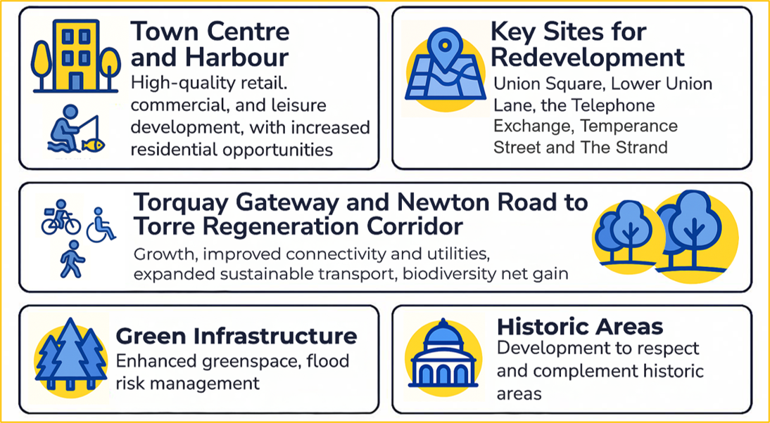
2.10Torquay Town Centre and Harbour will be a focus for regeneration which supports its retail & commercial role. This means high quality development which improves the public realm and provides an improved, multifunctional town centre, including higher levels of residential development. Regeneration will achieve a leisure based retail offer at Torquay Harbour. The lower part of the town is within Torquay Harbour Conservation Area and development will be expected to complement the area’s historic character. Several key sites offer considerable opportunities for regeneration many of which will be further identified through Town Visions and master planning. Particular opportunities exist at Union Square, Lower Union Lane, the Telephone Exchange and Temperance Street. The Local Plan supports all brownfield town centre development unless there are substantial reasons to resist development.
Strategic Policy SDT3: Torquay Gateway – A sustainable growth hub for homes, jobs and nature View representations
Torquay Gateway (also referred to as Edginswell) is allocated as a Future Growth Area. High quality homes, employment, education and leisure facilities will be delivered in the Torquay Gateway to raise the economic prosperity of Torbay, and complement town centre regeneration and provide transport improvements serving the Bay.
The broad location is shown indicatively on the Key Diagram and on the Policies Map.
Development is expected to deliver:
- Around 550 new homes of which at least 30% should be affordable.
- At least 10 serviced self-build housing plots.
- A negotiated stopping place for Travellers, subject to a need being demonstrated.
- Mixed use employment space, with at least 25% of the area provided as Class E(G), B2 or B8 employment.
- Improved sustainable transport infrastructure including a new train station at Edginswell and park and ride/transport hub at, or close to, Gallows Gate.
- A landscape led design with integrated green infrastructure and biodiversity net gain. This could include increased provision for green burials.
- Subject to an ongoing assessment of need, a new primary school in conjunction with the delivery of new housing within the Edginswell Valley
A high quality of design will be required to enhance the built and natural environment, strengthen the sense of arrival into Torbay, and protect the green gap between Torbay and Kingskerswell.
Design should include the provision of high quality joined up green infrastructure maximising cross boundary linkages and active travel opportunities where appropriate.
Proposals should achieve ecological mitigation and a 10% Biodiversity Net Gain which should be delivered on-site as far as possible. Where it is not possible to achieve this level of biodiversity net gain on site, off-site provision will be considered, with a first preference for biodiversity enhancements within the Gateway area. Proposals must not adversely affect the integrity of the South Hams either alone or in combination with other plans or projects. Development must avoid effects on Greater Horseshoe Bat foraging habit commuting routes and dark corridors, in accordance with Policies NCS2 and NC1 to NC4. Development must avoid effects upon the Marine SAC and ensure sustainable water management in accordance with Policies ER1 to ER4.
Particular attention should be given to the protection of Cirl Bunting habitat.
Community and Corporate Plan – Community and People, Pride in Place, Economic Growth
Explanation
2.11Torquay Gateway is an important area of growth for Torquay and has been rolled forward from the Torbay Local Plan 2012-30. The masterplan (adopted in 2016) will be updated.
2.12In addition to providing new homes and jobs, there will be opportunities provided through strategic developments to improve connectivity for pedestrians, cyclists, public transport and motor vehicles within the area and to the town centre. The council is seeking to achieve a new train station at Edginswell to support growth in the area and provide an opportunity for sustainable transport including to Torbay Hospital.
2.13The setting of Edginswell Hall and Village will be conserved or enhanced. The effective provision of green infrastructure will be provided as part of the development to improve the accessibility of greenspace in the area, improve connections between communities, manage flood risk (particularly minimising run-off into Aller Brook) and maintain and enhance a strategic green gap between Torquay and Kingskerswell. The area could provide additional green burial opportunities as part its landscape and recreation provision.
2.14Care should be taken for development to avoid impact on the gas main running through the Future Growth Area.
Strategic Policy SDT4: Newton Road to Torre – A regeneration corridor for homes, jobs, health and connectivity
The regeneration of brownfield sites within the broad corridor between Edginswell and Torre, shown indicatively on the key diagram and policies map, will be supported to achieve:
- The safeguarding of Torbay Hospital as a key healthcare facility. Support for upgraded and improved healthcare facilities and key worker accommodation at Torbay Hospital to support its role as a sub regionally important healthcare facility.
- The improvement and modernisation of employment facilities whilst rationalising outdated space.
- The provision of around 500dwellings over the Plan period including affordable homes in accordance with Policy H7.
- The provision of water sensitive urban design and sustainable drainage.
- The improvement of facilities for active travel and coordinated public transport including the provision of improved integration of sustainable transport at Torre Station and delivery of a new railway station at Edginswell.
Community and Corporate Plan – Community and People, Pride in Place, Economic Growth
Explanation
2.15 SDT4 Newton Road to Torre Regeneration Corridor policy outlines a strategic vision for revitalising a key area in Torquay, with a focus on sustainable development and infrastructure improvement. It seeks to establish a regeneration corridor into Torbay Town Centre along key sustainable travel hubs and to maximise the use of available urban land, including at Torre Station. Proposals will be supported and expedited through masterplans. These will help to provide strong and coordinated active travel linkages between Torre Station, Edginswell Station, the Town Centre and other key destinations such as Shiphay Lane, Torbay Hospital and local employment hubs.
2.16The Torquay Gateway (Edginswell) Masterplan will be expanded to set out proposals for both Edginswell and the Newton Road to Torre regeneration corridor. There is scope for enhanced waiting areas, cycling parking and employment facilities, as well as a significant increase in residential development at Torre Station.
2.17There are opportunities for brownfield housing in this corridor. It will be important to safeguard and improve prospects for employment. However, there is scope to make better use of employment land in the area.
Paignton
Family fun on the foreshore and a centre for enterprise, electronics and entrepreneurship
Strategic Policy SDP1: Paignton – A strategy for sustainable growth View representations
Paignton will be rejuvenated through high-quality mixed-use development of key town centre, harbour, and waterfront sites. Improvement of the built environment will re-capture the historic character of the old town and appeal of the 19th Century ‘Garden Suburb’ to the east. Green infrastructure will underpin both recreational and flood-resilience measures, including a new sea wall. Residential uses will be supported in the town centre, subject to being safe for their lifetime, including from flooding and climate change risk.
Uses that reinforce deprivation in and around the town centre will be resisted.
The area around of Preston District Centre will be regenerated to make best use of underutilised brownfield land for housing, whilst maintaining the areas retail tourism, leisure functions.
The role of Goodrington as a leisure and employment hub will be promoted and enhanced, whilst protecting the area’s environmental assets and providing resilience to climate change. Extended train services to Goodrington will be supported.
The completion of housing at Great Parks and Development of the Future Growth Area to the west of Paignton will be delivered to provide employment and family housing opportunities. This will be underpinned by enhanced sustainable transport infrastructure and opportunities along the Western Corridor and A385 Totnes Road. These will take account of environmental sensitivity through a green infrastructure led design approach. Landscaping, biodiversity, and flood risk management measures will be required to minimise the environmental impact of development, particularly cross-boundary impacts.
Priority species such as Greater Horseshoe Bats and Cirl Buntings and their habitats will be safeguarded, and any impacts mitigated.
Paignton will provide a minimum of 37,000 square metres (net) of Class E(g), B2 or B8 employment floor space, and at least 3,400 new homes, equal to an average of around 170 dwellings a year over the Plan period 2022-42.
Community and Corporate Plan – Community and People, Pride in Place, Economic Growth
Explanation
2.18Paignton is the second largest town in Torbay, with a medieval core, C19th “Garden Suburb” east of the railway, and significant C20th residential suburbs. It includes the district centre of Preston.
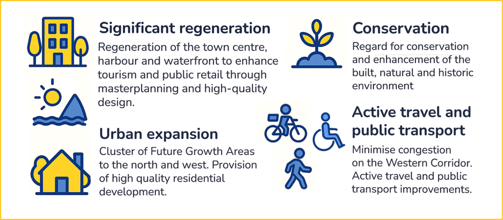
2.19There will be significant regeneration of Paignton town centre, harbour and waterfront areas to enhance its role as a tourism destination and provide an improved retail, leisure and commercial function. Rejuvenation of the town, including its historic core, will be supported through master planning, major investment and new development. Improved links within the town centre, upgrading the transport hub in the town centre, and connections to other parts of the Bay will be encouraged. Policy SDP2 deals with Paignton Town Centre in more detail. Regard should be had to the conservation or enhancement of the built, natural and historic environment, in accordance with other policies in this plan.
2.20The cluster of sites to the north and west of Paignton will continue to be a key focus for urban expansion as a Future Growth Area, as well as the completion of previously allocated sites at Great Parks. New housing and mixed-use developments will provide a range of residential, employment, of sites. These will require a high quality of design and appropriate landscaping to protect and enhance the rural backdrop to the area and should include the delivery of green infrastructure assets which provide multiple functions and benefits. On-line improvements and provision of active travel and public transport facilities will be required to minimise congestion on the Western Corridor. These will be accompanied by measures to encourage modal shift away from car use in order to manage demand on the road network.
Strategic Policy SDP2: Revitalising Paignton Town Centre and Waterfront - A destination for living, tourism and leisure View representations
Paignton Town Centre will be regenerated in order to improve its economy, historic, built and natural environment. The connectivity of the Town Centre to the Waterfront and surrounding areas will be restored and improved, including through the provision of a “Paignton Gateway” sustainable transport hub around Paignton train and bus stations. New developments will complement the area’s historic character, rejuvenating Paignton as a popular tourist destination, a modern Town Centre to support the needs of the local residents and tourists. New residential development will be supported subject to flooding considerations.
Development must be resilient to the effects of climate change including sea level rise and contribute towards reducing flood risk. Sleeping accommodation in basements will not be allowed in areas at risk of flooding. A new sea wall is proposed on Paignton and Preston seafront.
Development must avoid adverse effects on the integrity of the Lyme Bay and Torquay Marine SAC, including through recreation and water quality impacts, in accordance with Policies NS2, ER1, ER2, ER4 and W5.
The tourism role of The Esplanade and Harbour Core Tourism Investment Area (CTIA) will be enhanced and supported. A flexible approach will be taken to allowing residential use of holiday accommodation outside of the CTIA, in order to boost housing supply arising from former holiday accommodation. The introduction of houses in multiple occupation will be resisted in these areas.
The area is expected to provide at least 500 additional dwellings from major developments over the Plan period.
Community and Corporate Plan – Community and People, Pride in Place, Economic Growth
Explanation
2.21Paignton Town Centre will remain a focus for commercial and tourism activity. The Centre will be regenerated to strengthen and update its offer for businesses, tourists and residents. This will incorporate improved public space to help re-establish the formerly distinctive grid pattern of Paignton, linked to the regeneration of major development sites, connecting the medieval town with the Victorian garden suburb. Upgraded transport hub and facilities for travellers is supported around Paignton train and bus stations with measures to support modal shifts to sustainable transport and connectivity.
2.22The boundaries of the retail core and Core Tourism Investment Area will be drawn back to encourage residential led regeneration, whilst improving the provision of modern purpose-built holiday accommodation on the Esplanade. Policy TO1 deals with Core Tourism Investment Areas. Policies TC1 and TC4 deal with town centre retail, including primary and secondary shopping areas.
2.23It is critical that flood defence works are completed to address the effects of climate change in the form of the Paignton and Preston Promenade Coastal Flood Protection Scheme. Paignton and Preston Promenade coastal flood protection scheme - Torbay Council. Despite its vulnerability to flooding, Paignton Town Centre is a highly sustainable location for development and is well served by public transport. It is therefore sequentially preferable to other out of town locations as a focus for development. In some instances, an exceptions test will be required to support town centre development. All development must meet the requirements of site flood risk assessments and be safe for its lifetime. Development will need to avoid flood vulnerable uses in high-risk areas; in particular, basement flats will not be permitted in areas at risk of flooding.
Strategic Policy SDP3: Preston – A thriving district centre and Regeneration Hub for living and community
A regeneration hub around Preston District centre is shown on the Policies map and indicatively on the key diagram. The role of Preston as a district centre serving local needs should be safeguarded but marginal areas of the District Centre will be released for residential redevelopment. Regeneration of suitable brownfield land, including under-utilised employment space will be supported, including the provision of taller buildings subject to design and amenity considerations. The area is expected to provide at least 150 additional dwellings from major developments over the Plan period.
Opportunities to improve active travel and public transport facilities, and safe links to Torquay and Paignton train stations should be maximised.
Development should enhance the natural environment and support improvements to public open space at Hollicombe Park and Oldway Mansion and provide sustainable drainage and water sensitive urban design.
Developments in Preston must not adversely affect the integrity of the South Hams SAC or the Lyme Bay and Torquay Marine SAC including through effect on ecology or recreation, drainage or water quality impacts, in accordance with Policies NCS2, NC4, ER1, ER2, ER4 and W5.
Community and Corporate Plan – Community and People, Pride in Place, Economic Growth
Explanation
2.25The Local Plan supports new housing on brownfield sites in principle, subject to other considerations such as heritage and flooding. The Plan identifies particular brownfield regeneration opportunities in the vicinity of Preston District Centre, Paignton. This includes allowing more flexibility for residential development in the marginal parts of the District Centre and making better use of land within easy walking and wheeling distance of the A3022 traffic corridor. Support will be given to taller buildings subject to amenity and design considerations.
2.26 Public Open space at Hollicombe Park and Oldway Mansion will be protected. The need to find an economic use for Oldway Mansion will be considered subject to heritage and open space considerations.
2.27It is noted that parts of Preston are sandstone, and development will need to have regard to ground conditions.
Strategic Policy SDP4: Collaton St Mary – Sustainable growth in a connected village
Collaton St Mary is allocated as a Future Growth Area, primarily focussed on new homes. The broad location is shown indicatively on the Key Diagram and on the Policies Map.
Development is expected to deliver:
- Around 600 new homes, including at least 30% affordable housing
- At least 12 serviced plots for self-build housing
- A negotiated stopping place for travellers, subject to need being identified.
- Improved community facilities and strengthened village centre focussed on the east of the Future Growth Area
- Any retail (or other Class E/F1 uses) should be limited to meeting neighbourhood needs, and no retail use of more than 500 SQ M (net) will be permitted
- Improved drainage and sewerage infrastructure
- Conservation and enhancement of the area’s heritage, including listed buildings.
Development should be accompanied by upgraded transport infrastructure. This should include including improved walking, wheeling, cycling and bus routes and facilities along the A385 Totnes Road, and junction improvements at the junction of Stoke Road/Totnes Road. Development will need to contribute towards sewer and drainage infrastructure, including protection of the Water Meadow and watercourses from urban creep. Proposals must ensure that down-stream settlements are not put at increased risk of flooding.
Development in these locations should provide resilience to the effects of climate change, particularly through the provision of high quality joined up green infrastructure maximising cross boundary linkages and active travel opportunities where appropriate.
Proposals should achieve a 10% Biodiversity Net Gain which should be delivered on-site as far as possible. Where it is not possible to achieve this level of biodiversity net gain on site, off-site provision will be considered, with a first preference for biodiversity enhancements within the Collaton St Mary area.
Proposals must not adversely affect the integrity of the South Hams SAC alone or in combination with other plans or projects, including through effects on Greater Horseshoe Bat foraging habitat, commuting routes and dark corridors, in accordance with Policies NCS2, NC1 and NC4
Particular attention also must also be given to Cirl Bunting habitat.
Community and Corporate Plan – Community and People, Pride in Place, Economic Growth
Explanation
2.28The west of Paignton offers the largest area of land for expansion within Torbay, although there are infrastructure requirements that need to be met prior to or in parallel with major development. Sites allocated at Great Parks, Collaton St Mary, Yalberton, and White Rock will continue to be allocated, and the Local Plan expands on these areas as the least damaging option for greenfield expansion. The South of the wider growth area at Inglewood falls within the Broadsands Churston and Galmpton Neighbourhood Plan area
2.29Development is dependent upon a vision led approach to improve reduce dependence upon private cars using the A3022 Western Corridor. Improvement works to Kings Ash and Tweenaway Cross have taken place during the previous Local Plan (2012-30) but scope and funding for further road improvements is likely to be limited, and therefore demand management and support of walking, wheeling, cycling and public transport infrastructure will be important to support successful development.
2.30The A385 Totnes Road needs a comprehensive approach to reduce existing congestion and minimise the number of new accesses onto it. The Local Transport Plan 4 2025-30 note that sustainable transport will be prioritised in order to unlock growth. Development should provide new, segregated and continuous walking, wheeling and cycling route, physically separated from traffic, alongside high-quality bus provision and transport demand management.
2.31The wider corridor is well served in relation to retail, schools and employment, but connectivity between the different growth areas is somewhat disjointed. Improved permeability between development areas is needed should be given a high priority in masterplanning of the area and as part of travel plans supporting development proposals.
2.32Improved sewerage infrastructure will be needed to connect development to the wastewater treatment works at the West of Paignton.
2.33An update to the current Masterplan (adopted 2016) will support additional development at Collaton St Mary. The 2016 Masterplan proposes about 460 dwellings which remain proposed for development where not yet built (in 2025 some are under construction). At least 150 additional dwellings are expected to be provided beyond the boundaries of the 2016 Masterplan.
Strategic Policy SDP5: Long Road, Yalberton - Sustainable living and employment neighbourhood View representations
Land to the west of South Devon College and south of Berry Acres is allocated as a Future Growth Area delivering a mix of new homes and employment land. The broad location is shown indicatively on the Key Diagram and on the Policies Map.
Development is expected to deliver:
- An additional 650 dwellings, including at least 30% affordable housing.
- At least 12 serviced plots for self-build housing.
- Provision of a negotiated stopping place for travellers or provision of an alternative site, subject to need being identified.
- 25% of the area to be Class E(g), B2 or B8 employment delivering at least 20,000 sq m of industrial development. Land allocated for industrial development will be safeguarded for such purpose.
- The role of South Devon College will be supported and enhanced as a key facility serving a wider strategic education, training, employment and community role.
- The designation of Devonshire Park retail centre as a District Centre, subject to improvements to active travel to and from the site. Outside of this, new retail provision in the area should be located in the local centres and strictly of a scale to meet local needs (around 500 sq. m maximum).
- Yalberton Household Waste and Recycling Centre and Yalberton Quarry will be safeguarded for municipal waste and associated purposes and should not be sterilised from operation by nearby developments.
- Strategic landscaping and open space to protect the highest parts of the landscape and rural setting of Higher and Lower Yalberton.
- Yalberton Valley including Lower and Higher Yalberton will be protected for its biodiversity and to conserve and enhance its local historic environment.
Development must be accompanied by upgraded walking, wheeling, cycling and sustainable transport infrastructure, within the Future Growth Area and along the Western Corridor to provide greater permeability within the area and to improve sustainable transport linkages to Paignton town centre. Development will be supported by and improvements to sewerage capacity
Development in these locations should provide resilience to the effects of climate change, particularly through the provision of high quality joined up green infrastructure maximising cross boundary linkages and active travel opportunities where appropriate.
Proposals should achieve a 10% Biodiversity Net Gain which should be delivered on-site as far as possible. Where it is not possible to achieve this level of biodiversity net gain on site, off-site provision will be considered, with a first preference for biodiversity enhancements within the Long Road, Yalberton area.
Proposals must not adversely affect the integrity of the South Hams SAC and Marine SAC, alone or in combination with other plans or projects including through effects on Greater Horseshoe Bat habitat, commuting routes and dark corridors, in accordance with Policies NCS2, NC1and NC4. Particular attention should also be given to Cirl Bunting habitat.
Community and Corporate Plan – Community and People, Pride in Place, Economic Growth
Explanation
2.35This area includes the Local Plan 2012-30 Future Growth Areas of Bery Acres, Yalberton (Wilkins Drive) and White Rock. The south of the area being built out at Inglewood is within the Broadsands Churston and Galmpton Neighbourhood Area but functionally relates to the developments on the West of Paignton. The Plan proposes further areas to those allocated in the previous local plan or with planning permission. These should deliver at least 200 additional dwellings beyond the number previously proposed at Berry Acres and Devonshire Park in the Torbay Local Plan 2012-30, and approved Inglewood development. At least 20,000 sq m of employment land (beyond that already built out at March 2025) should be delivered in the Future Growth Area, with an emphasis on early delivery. It is important that sufficient employment land in the area is safeguarded for such use, or sufficient financial contribution made as a site deliverability matter to unlock the provision of nearby sites. These may include Claylands Phase 2. South Devon College, Epic and a range of other businesses in the area form part of Torbay’s “high tech hub. Supporting the expansion and safeguarding these is an important Plan objective. Improvements and expansion of South Devon College, including provision of an energy centre / sustainable construction centre and similar facilities are a vital economic, social and cultural asset to the bay.
2.36The role of Yalberton and Yalberton Quarry will be safeguarded for waste purposes, and residential uses should not encroach on these, where this could introduce amenity conflicts. The role of Yalberton and Yalberton Quarry will be safeguarded for waste purposes, and residential uses should not encroach on these, where this could introduce amenity conflicts. Detailed proposals for area will be supported and expedited through a new Masterplan for the area. The Yalberton Valley to the West of the Future Growth Area contains areas of landscape, ecological and heritage importance, including several listed buildings. It is important that a strategic landscape buffer and traffic management is put in place to protect the character and integrity of this area and its designated heritage assets. This valley and historic environment may in the future be designated as a conservation area.
2.37Please note that Policy SDBCG2 Land at Inglewood and its environs north of Windy Corner could also fit within this section of the Plan but is included withing the BCG Village part of the Plan to reflect the Neighbourhood Plan Forum arrangements for the area.
Policy SDP6: Clennon Valley - Active leisure and nature hub View representations
Developments within the Clennon Valley Leisure Hub will comprise a mix of recreation, active travel and green infrastructure. It will deliver improvements to the recreation and tourism offer, providing safe, continuous and accessible walking, wheeling and cycling routes, and a landscape-led green corridor. whilst enhancing green infrastructure and biodiversity in the area.
Development will comprise a landscape and green infrastructure-led design approach to ensure the conservation of a strategic green corridor linking Goodrington’s beaches with the top of the valley and nearby holiday accommodation and parks. Development in this sensitive location should provide resilience and adaptation to the effects of climate change and safeguard or enhance the integrity of important wildlife sites and features, including the local water features and ecology and the wider South Hams SAC and Marine SAC.
Development must not adversely affect the integrity of the Lyme Bay and Tor Bay Marine SAC or South Hams SAC alone or in combination with other plans or projects, including through effects on Greater Horseshoe Bat foraging habitat, commuting routes and dark corridors, in accordance with Policies NCS2 and NC4.
Community and Corporate Plan – Pride in Place
Explanation
2.38Clennon Valley is an important recreation, leisure and tourism destination for the whole Bay. It provides a good opportunity for expanded sports and recreation provision. Tourism uses, including water-based activities and holiday accommodation, are appropriate to this location. Seafront development should provide opportunities to improve permeability and public access to the beach and be of a high quality reflecting the area’s important natural setting.
2.39Proposals should promote pedestrian and green links west-east, connecting South Devon College, Paignton Community College, Paignton Zoo, Long Road South Business Park and the wider countryside to Quaywest, Goodrington Sands and the sea.
2.40Development should incorporate and contribute towards flood alleviation and sea defence measures to provide resilience to climate change and providing biodiversity enhancements, using sustainable drainage methods wherever practicable. Flood vulnerable uses will be directed to areas of no/low flood risk.
2.41 The integrity of the green valley that connects the open countryside with the sea should be conserved and enhanced. Any built development should be located and designed to conserve this important natural corridor and respect its natural setting.
Brixham View representations
A colourful collision of creativity, craft, food and fishing
Strategic Policy SDB1: Brixham – A strategy for sustainable growth View representations
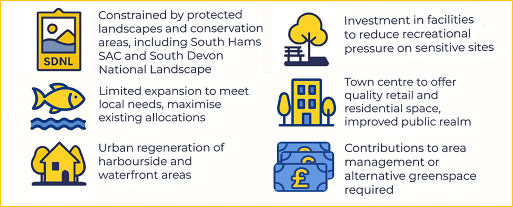
Brixham will accommodate appropriate but limited new growth aimed at regenerating the town centre and built-up area, to sustain a viable town centre retail function, maintain an appropriate range of community facilities and meet local housing and employment needs.
Brixham’s role as a fishing port and resort, with a nationally important and historic working and creative harbour, will be enhanced.
New maritime facilities including improved water-borne transport, employment space, and facilities to support the fishing industry including a Northern Arm Breakwater are proposed, subject to the area’s important natural and marine environment being safeguarded and enhanced.
Brixham will deliver around 5,000 square metres of employment floorspace and at least 400 dwellings over the Plan period, equal to around 20 dwellings a year, aimed at meeting the needs of local people.
Development is expected to conserve or enhance the local historic environment
The National Landscape and its setting will be conserved and enhanced to protect its intrinsic landscape and biodiversity value, and for recreational and tourism purposes. Major development will not be permitted within the South Devon National Landscape, unless brought forward through a neighbourhood plans, and is shown to be in the public interest.
Development in Brixham will only be acceptable if it can be accommodated without prejudicing the integrity of the South Devon National Landscape, and South Hams Special Area of Conservation. Development should be resilient to flood risk and the effects of climate change.
Community and Corporate Plan – Community and People, Pride in Place, Economic Growth
Explanation
2.42This policy relates to the “parished” town of Brixham, i.e. the Brixham Town Council area. Brixham is bounded by the South Devon National Landscape (formerly AONB) which constrains its outward expansion. The area around Berry Head is a Special Area of Conservation, which is an international important wildlife designation. The coast is also bounded by the Lyme Bay and Torbay Marine SAC designated for its reefs and sea cave habitat, and Marine Conservation Zone designated for its seagrass, and diverse marine habitats. These constraints make it difficult for Brixham to meet its need for housing and other facilities, and some limited development will need to be accommodated within the adjoining BGC Villages area. It is important that this be limited to meeting local needs and that Brixham meets as much of its needs as possible.
2.43It will be important that longstanding development allocations such as Northcliffe Hotel, Middle Street Car Park, Paint Station and former St Mary’s dairy are built out and residential opportunities maximised.
2.44There is scope for further urban regeneration within the harbourside and waterfront areas of Brixham. Land at Freshwater Quarry and Oxen Cove, and adjacent to the Fishmarket will provide employment space to support and improve maritime industries. The Northern Arm Breakwater has featured in previous Plans and continues to be allocated, subject to an Environmental Impact assessment and Habitats Regulations Appropriate Assessment. However additional floorspace can also be created within existing harbour land in the shorter term.
2.45The tourism and leisure economy will be developed in a way that respects the towns rich historic and environmental character.
Strategic Policy SDB2: Revitalising Brixham’s Town Centre, Harbour and Waterfront - A destination for living, maritime activity and tourism
Mixed use regeneration is proposed in the Brixham Town Centre, Harbour, and waterfront areas, to provide a range of retail, employment, leisure, and residential facilities appropriate to the scale of the town. The purpose of this development is to meet local needs, to sustain Brixham’s role as a vibrant maritime resort, to support and develop traditional industries and diversify the economic base. The provision of a Northern Arm Breakwater is proposed subject to the outcome of an Environmental Impact assessment and Habitats Regulations Appropriate Assessment.
Residential development above commercial
Proposals for residential above commercial will be encouraged and supported, subject to amenity considerations and safeguarding the role of the working harbour and fish processing activities.
Brixham town Centre is expected to provide around 50 dwellings over the Plan period from major developments, so long as these can be achieved within the area’s constraints and would not undermine the role of the working harbour.
Development must take flood risk and water management into account, and make sustainable drainage, flood risk mitigation and resilience measures central to the design of development.
Proposals will be permitted only where it can be demonstrated that they will not adversely affect the integrity of the South Hams SAC or the Lyme Bay and Torbay Marine SAC, alone or in combination with other plans or projects. This includes through new recreation pressure or effects on Greater Horseshoe Bat foraging habitat, commuting routes and dark corridors, or through recreation and water quality pathways in accordance with Policies NCS2, NC4, and ER1 to ER5.
Community and Corporate Plan – Community and People, Pride in Place, Economic Growth
Explanation
2.47Brixham Town Centre will continue to provide local needs and quality ground floor retail facilities with residential or commercial above. This will include the redevelopment of the car park at Middle Street, to provide commercial space, car parking to serve the town, residential units and improved public realm. The scheme will create a high quality and vibrant public realm.
2.48The harbour area will have improved sustainable transport links to reduce the need to travel by car. There will be improved walking, wheeling, cycling and maritime facilities to increase the permeability of the town centre and provide a high quality working and recreational environment for residents and tourists.
Strategic Policy SDB3: Berry Head to Sharkham Point - Coastal conservation and recreation management View representations
The Berry Head to Sharkham Point Area will be conserved and enhanced to protect its landscape and biodiversity value. Development will only be permitted within the area where it is shown to enhance the area’s environmental or landscape value and does not adversely affect the integrity of the South Hams SAC South Devon National Landscape, and Lyme Bay and Torbay Marine SAC. This includes through creating new recreation pressure or effects on Greater Horseshoe Bat core (juvenile) sustenance zone, foraging habitat, commuting routes and dark corridors, or through recreation and water quality impacts, in accordance with Policies NCS2, NC4, ER1 to ER4, and W5.
Should existing uses, including holiday parks in the SDNL and Core GHB Sustenance Zone cease to operate, there will be an expectation that they should revert to open countryside.
Community and Corporate Plan – Pride in Place
Explanation
2.49. The Policies Map shows a ‘Berry Head Special Area’ covering the country park and adjoining area. This is shown to clarify the range of designations lying within it including National Landscape and Special Area of Conservation. This area is the most environmentally sensitive, and peripheral part of Torbay.
2.50. There is existing tourism development and a need to balance competing pressures for tourism and recreation with safeguarding the internationally important environmental assets, and reducing existing degradation on the SAC including through recreation impacts. The area therefore needs careful management. Development within an 8km zone of influence will be required to contribute to improved management or the provision of new alternative areas or enhanced facilities at new or existing alternative recreational sites. There is unlikely to be sufficient land for a single suitable alternative natural greenspace (SANG), so a range of sites and options will be supported.
2.51. Development that may have an adverse effect on the landscape and scenic beauty of the area, or encroach further upon the area’s special characteristics, will be considered to constitute major development and only be approved if clearly demonstrated to be in the public interest.
Brixham Hinterland and Rural Villages
Rural hinterland to Brixham, valued landscapes and biodiversity, green farmland and villages rich in history
Broadsands Churston and Galmpton (BCG Villages)
Strategic Policy SDBCG1: Broadsands, Churston and Galmpton Villages - Sustainable living and landscape protection strategy View representations
North and West of Windy Corner
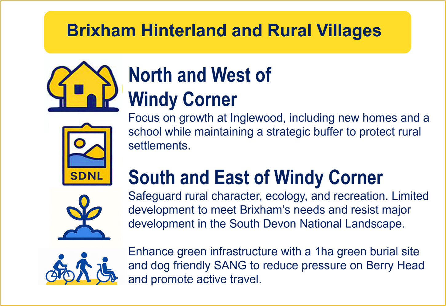
The focus of growth in the Broadsands Churston Galmpton Villages (BCG villages) Neighbourhood Plan area will be on the approved site at Inglewood and land to the North of Windy Corner (SDBCG2). This will include the provision of new homes and delivery of a school site on the Inglewood development, as shown on the Policies map.
A strategic buffer between Inglewood and Churston, Galmpton and Broadsands, will be maintained to safeguard the landscape character, ecological integrity, recreational and economic value of the rural settlements to the south and east of Windy Corner (SDBCG3).
The BCG Area is expected to provide a minimum of 500 dwellings over the Plan period with the bulk in the vicinity of Inglewood North and west of Windy Corner. (BCG2)
South and East of Windy Corner
The focus of the plan to the south and east of Windy Corner (SDBCG3) will be to safeguard the area’s rural character, landscape, ecology, environmental and recreational value whilst strengthening settlement gaps and improved provision of green infrastructure.
A park and ride site (transportation hub) serving Brixham is proposed, subject to assessment of landscape, ecological and transport impacts.
Major development in the South Devon National Landscape will be resisted.
The Overall BCG Villages Area
The BCG area will provide appropriate green infrastructure including an area of search for a burial site, a nature reserve and dog-friendly recreation area and facilities to reduce recreational pressure on Berry Head and maximise active travel opportunities.
Community and Corporate Plan – Community and People, Pride in Place
Explanation
2.52The area between the south and west of Paignton and the North of Brixham is covered by the Broadsands Churston and Galmpton Villages Neighbourhood Forum Area (BCG Villages). This area was formerly part of the Brixham Peninsula Neighbourhood Plan (adopted June 2019) and forms the rural hinterland to Brixham.
2.53The BCG area broadly falls into two halves. The area to the north of Windy Corner junction and containing the Inglewood development area and relates functionally to the developed area of White Rock and the west of Paignton. Policy SDBCG2 sets out considerations for this area.
2.54Windy Corner marks where the “Western Corridor” (A3022) rejoins the Torbay Coast Road (A379). The junction is located within Common Land and is operating at above capacity, although recent junction improvements have improved capacity somewhat. Despite efforts over many decades, no solution, or funding, has been identified to overcome this bottleneck. Measures within the Local Plan will manage demand for use of the road and promote better conditions for walking, wheeling, cycling and public transport. There is potential for improved rail accessibility to Galmpton via the Paignton to Dartmouth Steam Railway. However, this is primarily a leisure route at the present time.
2.55The land to the south of Windy Corner contains Galmpton Common, The South Devon National Landscape, Greater Horseshoe Bat sustenance and landscape connectivity zones, as well as conservation areas covering the rural villages of Churston Ferrers and Galmpton. This area is therefore environmentally constrained as well as relatively inaccessible. Policy SDBCG3 deals with the Rural Villages South of Windy Corner, with a focus on conserving the area’s rural character. Nevertheless, some limited development is proposed on the boundary with Brixham in order to meet the town’s local needs. Other major development in the National Landscape or GHB Core Sustenance Zone will be resisted.
2.56The BCG area will provide important green infrastructure which is essential to supporting other development in Torbay. This includes areas for nature conservation and new and enhanced recreation and dog-friendly facilities to mitigate development pressure on the South Hams SAC. Whilst a single Suitable Alternative Natural Greenspace (SANG) would be supported, it is more likely that a range of facilities will be provided including dog recreation areas. Developer contributions will be sought towards providing these as a “site deliverability matter” as set out in Chapter 9. Cemetery space (but no crematoria) will also be provided in the BCG area, potentially sharing parking and ceremony space in conjunction with the proposed mobility hub in Policy TAS.
Strategic Policy SDBCG2 Land at Inglewood and its environs north of Windy Corner View representations
Development in the north of the BCG Area will focus upon the approved development at Inglewood with some expansion into adjoining areas, as shown on the Policies Map. Sustainable transport and other functional links with the White Rock area and Paignton will be strengthened and improved.
Development in the SDBCG2 Area should achieve the following:
- A minimum of 450 dwellings from major developments over the Plan period (focussed at Inglewood and the adjoining area within the H2P4 Future growth Area).
- At least 30% affordable housing on sites within the settlement boundary or areas proposed for development.
- The provision of a school and playing pitch.
- At least 500 sq. m of employment land within Class E(G), B2 or B8.
- Maintenance and enhancements to public open space, including recreation facilities appropriate to the location, and enhancement of countryside access.
- The retention and enhancement of a green landscape buffer between Inglewood and Whiterock to the north, Galmpton to the South and the National Landscape to the South and West.
Development in these locations should provide resilience to the effects of climate change, particularly through the provision of high quality joined up green infrastructure maximising cross boundary linkages and active travel opportunities where appropriate.
Proposals should achieve a 10% Biodiversity Net Gain which should be delivered on-site as far as possible. Where it is not possible to achieve this level of biodiversity net gain on site, off-site provision will be considered, with a first preference for biodiversity enhancements within the BCG Villages area.
Proposals must not adversely affect the integrity of the South Hams SAC, alone or in combination with other projects including through recreational pressure or effects on Greater Horseshoe Bat functionally linked habitat, commuting routes, dark corridors or recreational pressure at Berry Head to Sharkham Point, in accordance with Policies NCS2, NC1, and NC4. Particular attention should also be given to the protection and enhancement of Cirl Bunting habitat.
Community and Corporate Plan – Community and People, Pride in Place, Economic Growth
Explanation
2.57Policy SDBCG2 deals with land to the north of Windy Corner. The bulk of the area is covered by the Inglewood development (under construction in 2025). Additional development opportunities in the Inglewood Area are shown on the Policies Map. The areas should provide for a school as shown on the Inglewood Masterplan (and Legal Agreement to application P/2017/1133 and varied by P/2023/0377). If not required for primary purposes, it should be retained for other education requirements.
2.58The area is expected to provide around 450 dwellings and 500 sq m of employment land over the Plan period in the area within Torbay.
2.59Land to the west of Waddeton Road is within South Hams and may be promoted for development to the neighbour authority. It will be important for joint working and agreement on cross-boundary matters. In addition, some ecological mitigation and agricultural mitigation land for development at Inglewood is located within the South Hams. This relates to mitigation of impacts on the South Hams Special Area of Conservation (Greater Horseshoe Bat sustenance zone and other ecological mitigation), so it will be a matter of Habitats Regulations compliance to ensure that sufficient mitigation is provided to offset the impact of the Inglewood development. The land is also within the setting of the South Devon National Landscape (former AONB), and a high-quality landscape led design to any further development will be needed to minimise additional impact on the National Landscape.
2.60The south of the SDBCG2 area is closer to the National Landscape and the village Galmpton. A green buffer between Inglewood and Galmpton should be maintained to provide a settlement gap and prevent coalescence of Paignton’s southwards development with Galmpton. The area may be suitable for a green burial site and associated facilities to meet Torbay’s need for cemeteries, and is shown within the area of search. This should help reinforce the undeveloped settlement gap.
Policy SDBCG3: Rural villages south of Windy Corner – Landscape, ecology and settlement gap protection zone View representations
Development to the South of Windy Corner will focus upon protecting the area’s significant landscape, environmental, historic and agricultural character, whilst providing sufficient development to meet the local needs.
The BCG3 area is expected to provide around 80 dwellings from major development, mainly at Copythorne Road and 500 sq m of employment space within Class E(G), B2 or B8. The BCG3 area should also provide a dog friendly natural green spaces with recreation and leisure facilities appropriate to the area’s rural setting, to provide an alternative to Berry Head.
The area will also provide a park and ride facility serving Brixham, ideally forming a recreational transport hub within safe and easy onward mobility opportunities, including the provision of walking, wheeling and cycling routes.
The South Devon National Landscape and its setting will be conserved and enhanced to protect its intrinsic landscape and biodiversity value.
Major development will not be permitted within the National Landscape unless brought forward through a Development Plan, and shown to be in the public interest. Non-major development in the National Landscape will only be allowed as a rural exception to provide affordable housing for local people.
Proposals should achieve a 10% Biodiversity Net Gain which should be delivered on-site as far as possible. Where it is not possible to achieve this level of biodiversity net gain on site, off-site provision will be considered, with a first preference for biodiversity enhancements within the SDBCG3 area.
All development in this sensitive location must not adversely affect the integrity of the South Hams SAC alone or in combination with other plans and projects. All development must adhere to planning guidance for Greater Horseshoe Bats and secure avoidance and mitigation to maintain foraging habitat, roosting opportunities, connectivity and dark corridors. These should achieve no increase in lighting above 0.5 lux in bat flyways. All development must avoid or mitigate additional recreational pressure at Berry Head to Sharkham Point, in accordance with Policies NCS2, NC1 and NC4.
Existing green infrastructure assets, trees, hedgerows, and connectivity between individual assets should be safeguarded or enhanced.
Community and Corporate Plan – Community and People, Pride in Place,
Explanation
2.61The land within the BCG Villages to the south of Windy Corner has substantial environmental constraints. It is partly within the South Devon National Landscape (formerly AONB), and the open country around Kennels Lane, Galmpton and Churston Ferrers forms an important valued landscape within the setting on the National Landscape. The land is also within the Sustenance Zone and landscape connectivity zone for greater horseshoe bats associated with the Berry Head maternity roost, which is part of the South Hams. It contains Torbay’s largest area of Torbay’s Grade 2 agricultural land. The rural villages have heritage significance.
2.62Any development beyond the approved development at Copythorne Road should be minor and limited in nature and aimed at meeting the area’s local needs. The council will take the General Permitted Development Order (10 dwellings/1000 sq. m) as a starting point when considering whether development in the NL is “major” but may apply a smaller threshold where proposals could have a significant impact on landscape and scenic beauty (see paragraph 67 of the 2024 NPPF).
2.63The area provides opportunities for enhanced public and active transport, linking with green infrastructure, tourism, leisure and other uses of the area. Ideally this should capitalise on the area’s rich tourism and Agatha Christie associations. It will be important to manage recreation pressure and reduce damage to the calcareous grassland at Berry Head. The SDBCG3 area should therefore include an alternative natural greenspace (SANG or similar provision) with dog friendly leisure/recreation facilities appropriate to the rural location. This will be part funded by development contributions from development within the Berry Head 8Km recreational zone of influence (see Policies NCS1 and NCS2). There is a need for cemetery provision in Torbay (see Policy SC6), and an area of search around Kennels Lane may be suitable for a green burial site in conjunction with other green infrastructure.
